Short day today, 13 miles. I got up late, which turned out to be a good thing when I noticed all the shark fins traversing about. Sometimes we forget that certain animals feed at certain times. Sharks feed at dawn and dusk. It would be a rare thing to be targeted by a shark but they are very active and on the move during those times. It’s common to hear about paddles being bitten.
Anyway, I left Molasses Keys because of the heavy winds that are coming. I wanted to get on an island that would allow me the freedom of going north if I have to. North of US-1 there’s plenty of windbreaks and shallow water. Picnic Island is a perfect location to catch an incoming tide and shoot north when the time is right. I’m sure that sounds confusing to most people but it’s the daily planning involved on this trip. If you’re not paying attention, you could easily get into a life or death situation. These currents down here can be a very serious force that does all kinds of crazy things to the water. I’ve mistakenly got into several extremely rough areas and had to power my way through it. The water becomes very unstable and hydraulic sometimes. You can easily get rolled and swept away. And it will happen in seconds; boat gone and you being pulled out to sea. Many times it’s just you out there, no other boats.
For anyone who reads this, be very careful about how you cross the Long Key Viaduct and the first and deepest channel at Seven Mile Bridge. The water flowing through there is fast and powerful. The incoming tide is less turbulent than the outgoing. The water is also much more shallow on the northern side of both crossings. The swells are big on the deep water near the bridges. It can become exhausting quickly if you’re not in shape. Also, you’re going to want to look down since the water is clear. I suggest you don’t. Forget about whatever it is that may be living down there. It will not bother you. The water is running so fast through those areas that looking down causes a little dizziness and you may easily flip over. Just focus ahead and stay away from the bridges. You don’t want to get pulled into one of the support columns. I’m not sure anyone ever talks about these types of things on any of the Facebook pages but it’s helpful information that other paddlers should know about. Then again, I’m not an expert and it may be common knowledge.
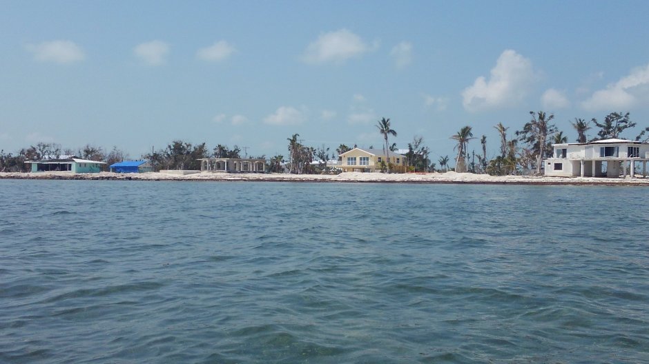
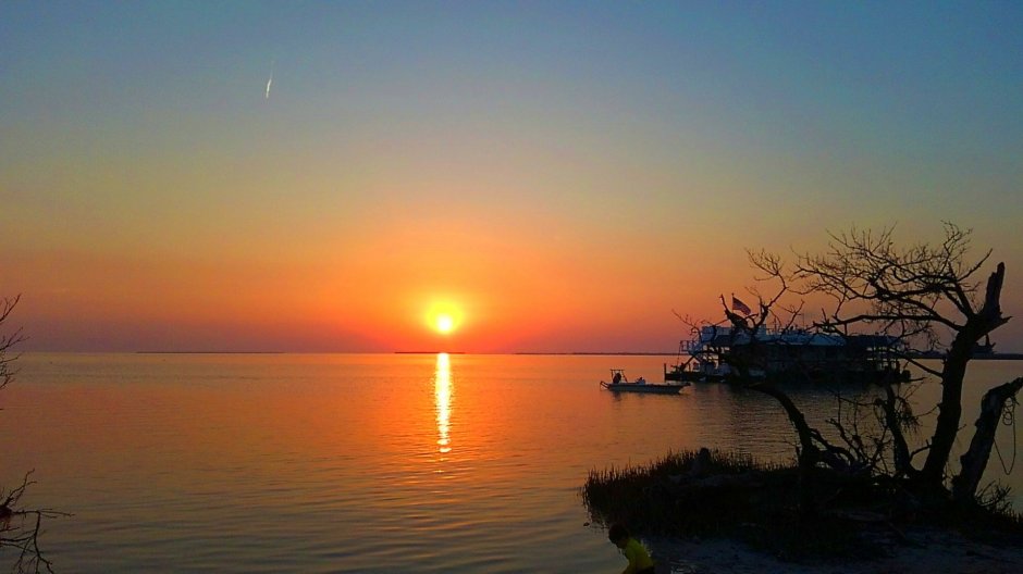
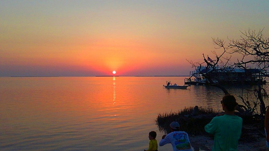
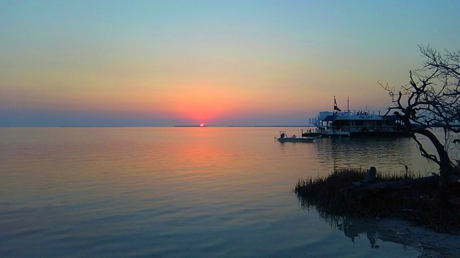
Anyway, Picnic Island is really neat. There’s little, colorful signs placed about that has a name, location, and mileage on each. There’s a few chairs and a fire pit. The sunset here is really something to see! I got to watch it with a really nice family. One woman was from Sweden. It was fun talking to them. Capt Jack even came over to watch it. He has a floating home anchored just off the island. I waded over and introduced myself when I first got here. He’s a nice guy. I’ll get some pics while I’m on the island to share.
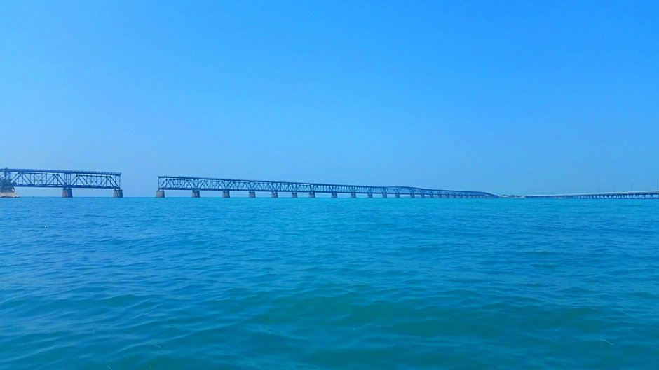
Oh yeah, I stopped at Bahia Honda State Park and refilled my water and ate a burger. It’s a nice park. I met an old man from Greece there. I love the various countries represented down here. The railroad bridge pic is from Bahia Honda.


I hadn’t heard of Picnic Island, I’ll need to go the next time I’m in the keys. Bahia Honda had some of the prettiest views I’ve ever seen.
LikeLiked by 1 person
It’s about a mile southeast of Ramrod Key. It’s nice little island to hangout on.
LikeLike
I lived in the Keys for 4 years and never heard of this. I have lived on Summerland, Cudjoe, and Key West.
LikeLiked by 1 person
Those are great places! The all seeing blimp followed my every move. 😋
LikeLiked by 1 person